Maps
Charlotte Conserved Lands Map
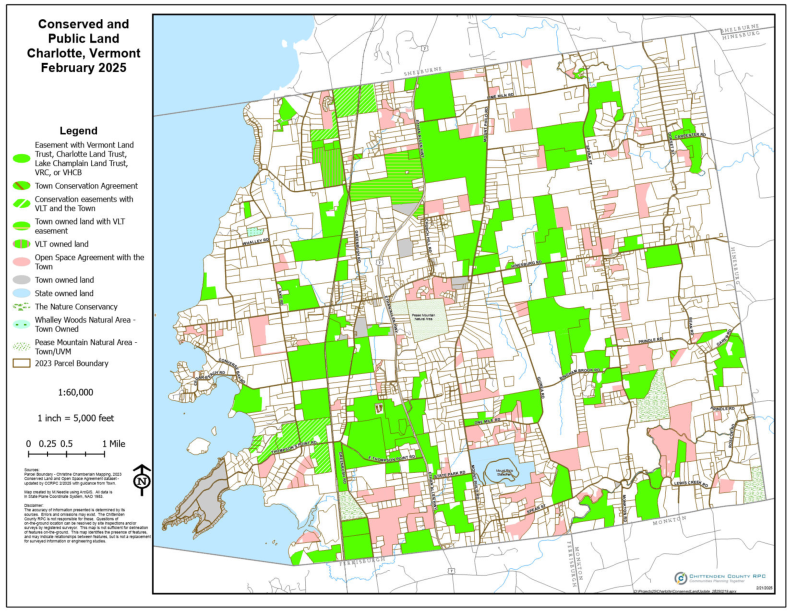
The Charlotte Conserved Lands Map is a result of a collaborative effort of the Town of Charlotte Planning Office, the Chittenden County Regional Planning Commission and the Charlotte Land Trust. It is revised annually. The legend describes the many categories of conservation easements on land parcels and highlights a variety of public and private property owners. The map reflects the success of CLT working with our conservation partners such as:
Download the Map
Charlotte Conserved Lands Map
The Charlotte Conserved Lands Map is a result of a collaborative effort of the Town of Charlotte Planning Office, the Chittenden County Regional Planning Commission and the Charlotte Land Trust. It is revised annually.
The legend describes the many categories of conservation easements on land parcels and highlights a variety of public and private property owners. The map reflects the success of CLT working with our conservation partners such as:


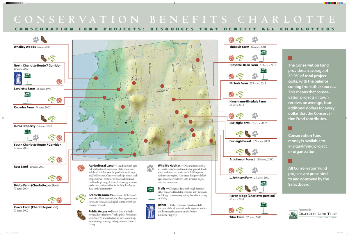
Conservation Benefits Charlotte
Here's a map we've created showing all the conservation projects in Charlotte funded partially using the Town of Charlotte Conservation Fund, up to and including 2012.